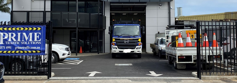
Prime Traffic Solutions is a family-owned and operated traffic management business, established in South Australia in 2007. The company specialises in providing comprehensive traffic management solutions for large-scale projects across Australia.
The company incorporated MetroMap’s high-resolution aerial imagery into their workflow, helping to streamline operations and enabling them to enhance their efficiency and effectiveness in visualising complex roads and traffic scenarios. They leverage MetroMap imagery to plan and execute high-stakes projects with precision and success.
Navigating Australia's extensive road networks poses many challenges for efficient project planning and execution, emphasising the crucial need for accurate road and traffic visualisation.
Ensuring accessible data for up-to-date road and traffic information becomes paramount, enabling effective decision-making throughout the management of small and large-scale projects, which rely heavily on detailed insights into traffic patterns, congestion points, and potential bottlenecks.
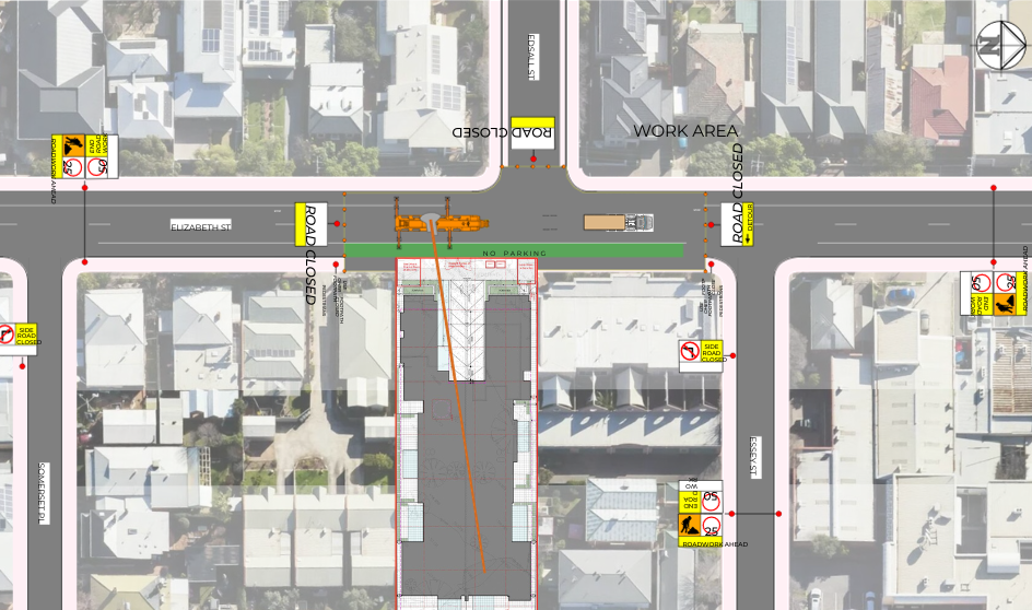
Prime Traffic Solutions integrated MetroMap imagery into their operations to address the above challenges and streamline their processes. Some of the key use cases for aerial imagery included comprehensive road visualisation, the ability to view projects across their life cycle, optimisation of routes, and data-driven decision making to optimise traffic flows and reducing delays.
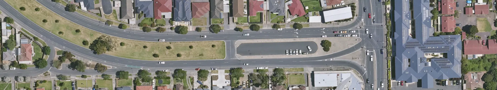
MetroMap provides accurate, high-resolution aerial imagery that enables Prime Traffic to visualise road layouts, intersections, roundabouts, and other critical traffic elements. This level of detail aids in understanding complex road networks and assists with the accurate planning of large-scale projects.
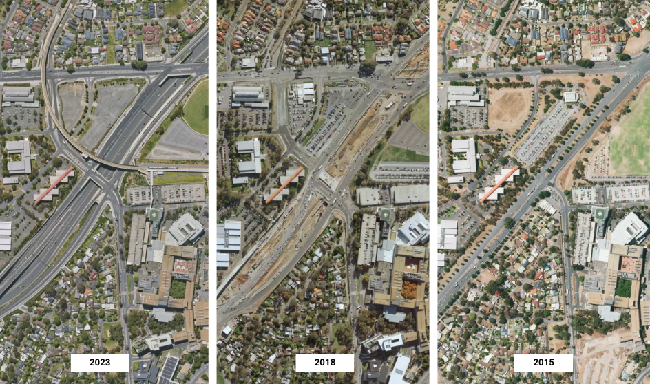
MetroMap's historic captures give Prime Traffic the ability to view a location over time helping to understand the lifecycle of a project and to plan for the future.
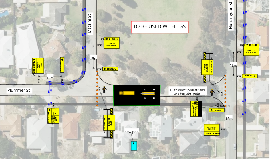
Prime Traffic utilises MetroMap to analyse various routes and identify the most efficient paths for traffic diversions and roadblocks on a regular basis. This helps minimise disruptions and reduce congestion on the road.
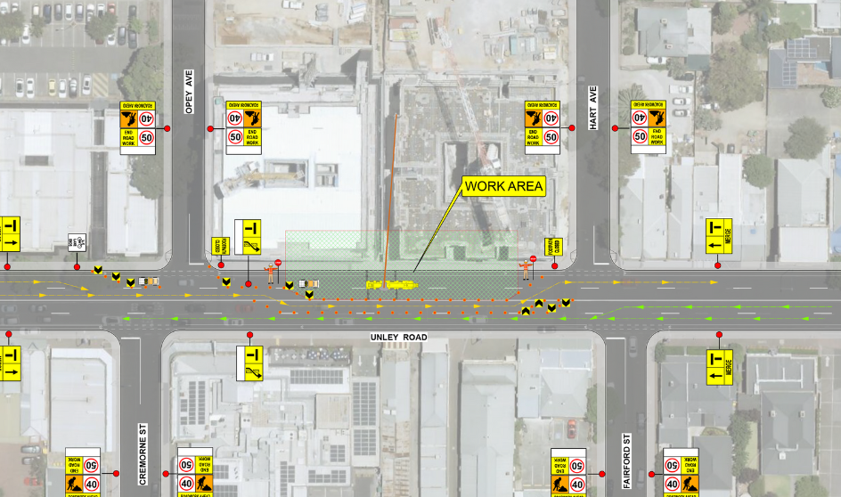
When ingesting MetroMap imagery with other traffic management software, Prime Traffic can make informed decisions based on accurate, up-to-date data. This approach optimises traffic flow, reduces delays, and enhances safety for road users and their 100+ employees.
Ben Killey, AWTM/Operational Planner WA says, MetroMap's high-resolution imagery is ideal for measuring out sites and for finding small details like pits and manholes. A good thing with MetroMap would be that if the latest photo has shadows or the trees are over grown, you can go back through the dates and find where there are no shadows or when the leaves have all fallen off, see below
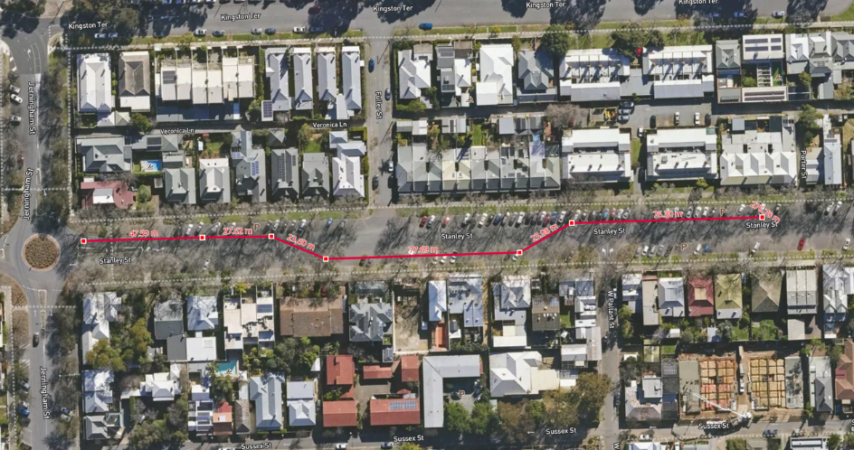
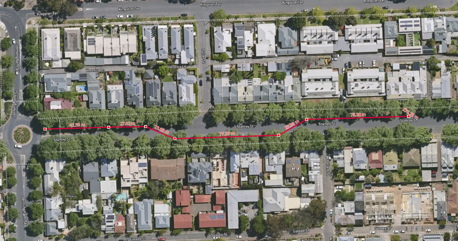
These images show the MetroMap line measurement tool being used over our high resolution aerial imagery.
Prime Traffic Solutions’ integration of MetroMap imagery has revolutionised their traffic management services. By harnessing the power of MetroMap’s accurate, up-to-date, high-resolution aerial imagery, the company has significantly increased their ability to plan, execute, and manage large-scale projects across Australia with precision, reducing congestion, ensuring safety, and delivering successful outcomes for their clients.
Click here to learn more about Prime Traffic Solutions.