Small and medium businesses rely on fast, accurate site insights to quote confidently and deliver quality work. In this on-demand webinar, Daniel O’Donnell (Head of Product) walks through how MetroMap helps teams reduce site visits, speed up quoting, and plan with greater confidence - using real project examples from roof maintenance to pool installation.
What this webinar and live demonstration of the MetroMap MapViewer cover:
- How MetroMap helps SMBs work smarter
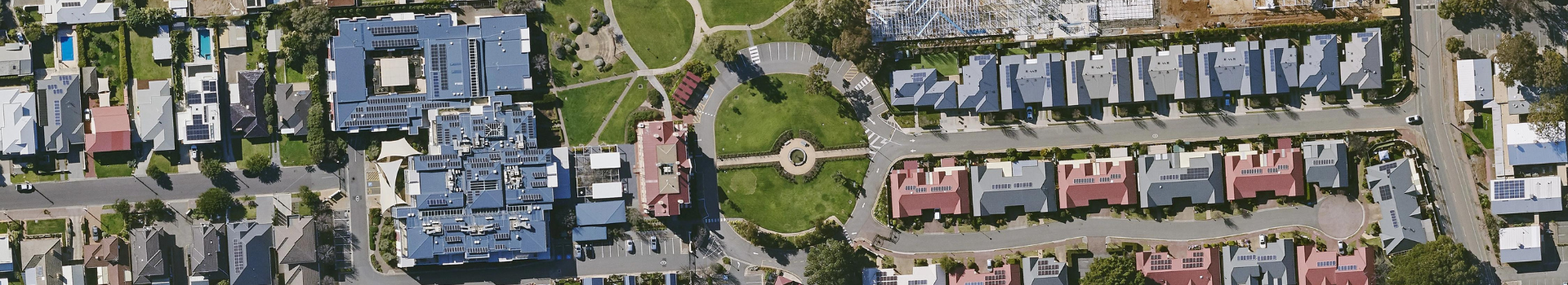
– Navigating to a site and understanding the available imagery
– Using markup tools to draw areas, measure distances, label obstacles, and assess access routes
– Saving, editing, and exporting project layers for collaboration
- Working with high-resolution imagery
– Taking screenshots for proposals
– Downloading georeferenced imagery for use in AutoCAD, Google Earth and GIS tools
– Rotating and framing imagery for clear, client-ready visuals
- Property data overlays and insights
– Cadastral boundaries and building footprint information
– Roof type, height, material and colour match data
– Identifying site constraints such as trees, chimneys, dishes and access limitations
- Advanced site assessment tools
– Image compare tool for reviewing seasonal or historical change
– Dynamic contours for quick understanding of slope and terrain
– Elevation Profile Tool for assessing ground and surface height along a path
– Using aerial + street-level perspectives together for clearer site context
- Importing & exporting projects
– Sending your drawings and measurements to contractors or collaborators
– Importing layers created in MetroMap, AutoCAD, GIS systems or Google Earth