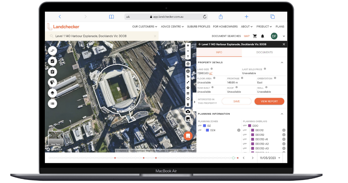
Landchecker platform with MetroMap imagery.
This case study explores how Landchecker, a Melbourne-based property information platform, integrates MetroMap high-resolution imagery to enhance the way users access and analyse property data.
By centralising and standardising information from various sources, Landchecker aims to simplify the process of gathering property details.
The integration of MetroMap imagery adds a visual dimension to the platform, enabling users to gain comprehensive insights into properties and make well-informed decisions.
This blog highlights Landchecker’s evolution, its diverse user base, the impact of MetroMap integration, and the benefits it brings to property professionals and consumers.
With a user base of over 100,000 including 5,000 advanced professionals, Landchecker caters to a wide range of individuals, including developers, builders, residential and commercial agents, architects, town planners, legal professionals, finance experts, investors, and other general consumers.
The platform offers accurate property data in one location, empowering users to access accurate and up-to-date data from various sources. Landchecker’s value proposition centres around providing fast, accurate, and user-friendly access to complex and widespread property data.
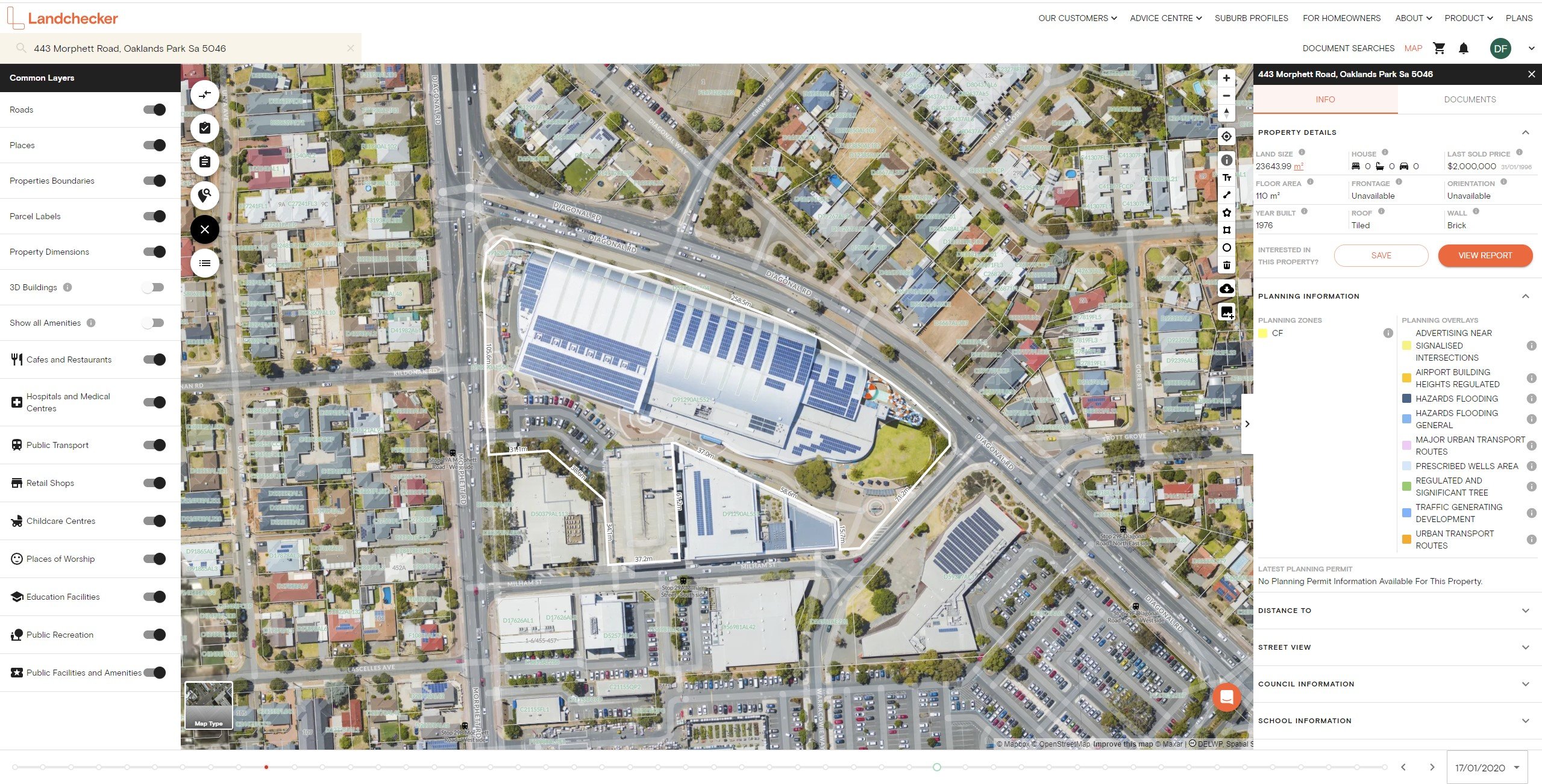
Acknowledging the importance of visualising property data, Landchecker partnered with Aerometrex to incorporate MetroMap’s high-resolution aerial imagery. This strategic collaboration enabled users to access current and historical maps of properties across Australia, empowering property professionals to conduct in-depth analyses at a parcel level.
By overlaying data sets encompassing zoning information, permits, and development approvals onto the imagery, users were equipped with a powerful toolset to make well-informed decisions.
The integration of high-resolution imagery not only enables property professionals to identify changes over time but also gives users the ability to evaluate the impact of various factors on a property’s value and potential.
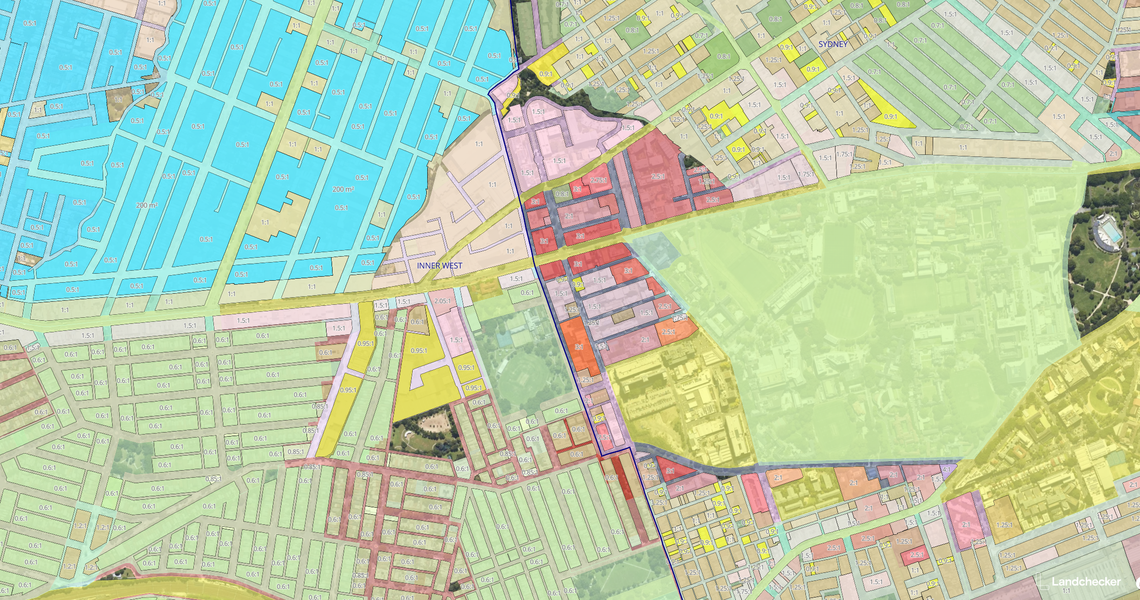
MetroMap imagery visualised within Landchecker's platform with zoning and planning layers.
The addition of MetroMap imagery changes the way Landchecker’s users approach property assessment and decision-making, opening up new avenues for exploration and evaluation.
The ability to visualise properties in greater detail and overlay relevant data sets simplifies the decision-making process.
Legal professionals find immense value when assessing properties for issues such as adverse possession or unauthorized modifications from leveraging imagery alongside permit information. Landchecker’s partnership with MetroMap helped expand its user base, attracting professionals and consumers who desired accurate and accessible property data.

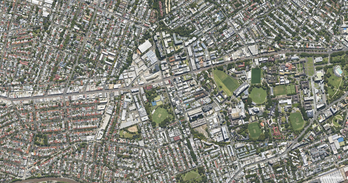
Landchecker's platform showcasing the vast amount of accessible data.
The successful integration of MetroMap’s high-resolution imagery into Landchecker’s platform enhances its capabilities and user experience. By providing a comprehensive property information platform with visual insights, Landchecker empowers property professionals, legal experts, and consumers to make well-informed decisions efficiently.
The collaboration with MetroMap enables Landchecker to align with users’ needs, improve data accuracy, and provide value to a diverse range of customers. As the platform continues to evolve and refine its offerings, the integration of advanced imagery data will play a pivotal role in driving Landchecker’s growth and expanding its reach within the property industry.
The seamless integration of MetroMap’s imagery has positioned Landchecker as a leading provider of streamlined property data, equipping users with the tools necessary to navigate the complex real estate landscape with confidence.