What is a vacant land parcel?
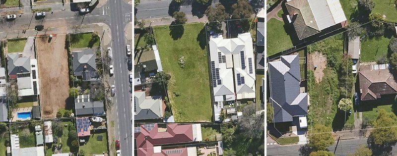
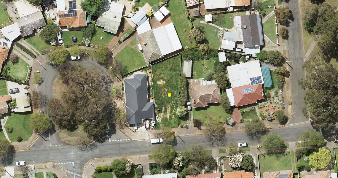
A vacant land parcel is a block of land in a suburban area that does not have any structures or buildings constructed on it. It is an empty or undeveloped piece of land - the result of a subdivision or removal of an old building. These parcels can remain vacant temporarily while new development plans are being formulated, permits obtained, or funding secured for future construction.
Mitigating the fire risk
Vacant land parcels are prone to overgrown vegetation such as dry grass, shrubs, and trees that can quickly become fire hazards during the hot and dry months. Without regular maintenance, these areas become ideal environments for fire to ignite and spread rapidly, endangering nearby houses and communities.
Addressing the fire risk requires multiple approaches including encouraging property owners to regularly maintain their vacant land parcels by clearing vegetation. In certain cases, councils encourage property owners to develop or sell these parcels to reduce the risk. These property owners can also face penalties for non-compliance.
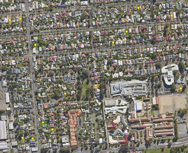
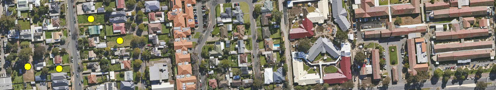
This can be done manually or through automated approaches. The presence of bushes, trees and grass can also be extracted to provide additional information and determine the potential risk associated with each vacant land parcel.
Manual identification consists of an individual examining their area of interest carefully using aerial imagery and identifying plots of land without a structure and with overgrown vegetation. While this approach can be performed if the council has the necessary human expertise, time and money, this task can become very cost & resource-prohibitive over large council areas.
In these cases, an automated approach leveraging cloud computing, and computer vision provides the best possible solution. Decision makers end up with the right location information to act on. This solution can take the form of a list of property addresses or/and a spatial dataset identifying each vacant land parcel.
The fire risk associated with vacant land parcels in Local Government Areas (LGAs) is a growing concern that demands immediate attention, especially with the increasingly dry weather. Through a combination of proactive vegetation management, increased monitoring and identification, community education, and stricter regulations, LGAs can significantly reduce the fire risk posed by these neglected areas.
By leveraging the latest MetroMap aerial imagery, computer vision and cloud-computing technology, targeted insights can be produced to empower councils to better monitor and identify vacant land parcels and high-risk vegetation growth. Accessible across Australia, for any area that falls within MetroMap’s coverage area, these insights can be tailored and delivered for proactive action.
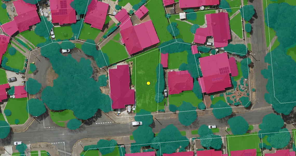
By applying machine learning algorithms to MetroMap's high resolution aerial imagery, we can identify vacant land parcels, as well as vegetation on these lands, accurately and cost-effectively. Vegetation layers can include grass / trees, helping to identify any potential fire risks.