


|
Enterprise Plan
|
||
| User Access | |||
| Users | 1 | 5 | Custom |
| Data Allowance1 | Unlimited | Unlimited | Custom |
| Web App Access |
|
|
|
| WMS/WMTS Access |
|
|
|
| MetroMap Image Dedicated for ArcGIS |
|
|
|
| View & Compare Imagery | |||
| Australia-wide high-resolution aerial imagery (historical and current)2 |
|
|
|
| 4-band near-infrared aerial imagery layers |
|
|
|
| Swipe tool: compare different imagery layers |
|
|
|
| Google Street View, base map layers (satellite & roads)3 |
|
|
|
| Measure, Draw and Manage Layers | |||
| Measurement, drawing and labelling tools |
|
|
|
| Save, export and screenshot drawn-up features in layers |
|
|
|
| Import user layers |
|
|
|
| High Resolution Image Downloads | |||
| Download high-resolution images in multiple file types and projections |
|
|
|
| Geoscape Feature Layers and Insights | |||
| Property Boundary (Cadastre) & details4 |
|
|
|
| Building Footprints and insights for roof, solar panel and swimming pool insights |
|
|
|
| Training & Support | |||
| Online documentation and in-app tool tips |
|
|
|
| Customer Support Team |
|
|
|
| Dedicated Account Manager |
|
|
|
| Optional training webinar |
|
|
|
|
| User Access | |
| Users | 1 |
| Data Allowance1 | Unlimited |
| Web App Access |
|
| WMS/WMTS Access |
|
| MetroMap Image Dedicated for ArcGIS |
|
| View & Compare Imagery | |
| Australia-wide high-resolution aerial imagery (historical and current)2 |
|
| 4-band near-infrared aerial imagery layers |
|
| Swipe tool: compare different imagery layers |
|
| Google Street View, base map layers (satellite & roads)3 |
|
| Measure, Draw and Manage Layers | |
| Measurement, drawing and labelling tools |
|
| Save, export and screenshot drawn-up features in layers |
|
| Import user layers |
|
| High Resolution Image Downloads | |
| Download high-resolution images in multiple file types and projections |
|
| Geoscape Feature Layers and Insights | |
| Property Boundary (Cadastre) & details4 |
|
| Building Footprints and insights for roof, solar panel and swimming pool insights |
|
| Training & Support | |
| Online documentation and in-app tool tips |
|
| Customer Support Team |
|
| Dedicated Account Manager |
|
| Optional training webinar |
|
| User Access | |
| Users | 5 |
| Data Allowance1 | Unlimited |
| Web App Access |
|
| WMS/WMTS Access |
|
| MetroMap Image Dedicated for ArcGIS |
|
| View & Compare Imagery | |
| Australia-wide high-resolution aerial imagery (historical and current)2 |
|
| 4-band near-infrared aerial imagery layers |
|
| Swipe tool: compare different imagery layers |
|
| Google Street View, base map layers (satellite & roads)3 |
|
| Measure, Draw and Manage Layers | |
| Measurement, drawing and labelling tools |
|
| Save, export and screenshot drawn-up features in layers |
|
| Import user layers |
|
| High Resolution Image Downloads | |
| Download high-resolution images in multiple file types and projections |
|
| Geoscape Feature Layers and Insights | |
| Property Boundary (Cadastre) & details4 |
|
| Building Footprints and insights for roof, solar panel and swimming pool insights |
|
| Training & Support | |
| Online documentation and in-app tool tips |
|
| Customer Support Team |
|
| Dedicated Account Manager |
|
| Optional training webinar |
|
| User Access | |
| Users | Custom |
| Data Allowance1 | Custom |
| Web App Access |
|
| WMS/WMTS Access |
|
| MetroMap Image Dedicated for ArcGIS |
|
| View & Compare Imagery | |
| Australia-wide high-resolution aerial imagery (historical and current)2 |
|
| 4-band near-infrared aerial imagery layers |
|
| Swipe tool: compare different imagery layers |
|
| Google Street View, base map layers (satellite & roads)3 |
|
| Measure, Draw and Manage Layers | |
| Measurement, drawing and labelling tools |
|
| Save, export and screenshot drawn-up features in layers |
|
| Import user layers |
|
| High Resolution Image Downloads | |
| Download high-resolution images in multiple file types and projections |
|
| Geoscape Feature Layers and Insights | |
| Property Boundary (Cadastre) & details4 |
|
| Building Footprints and insights for roof, solar panel and swimming pool insights |
|
| Training & Support | |
| Online documentation and in-app tool tips |
|
| Customer Support Team |
|
| Dedicated Account Manager |
|
| Optional training webinar |
|
EOFY Offer: Terms & Conditions
In addition to our Standard Subscription Terms for MetroMap, the special terms & conditions below apply to our limited-time EOFY offers.
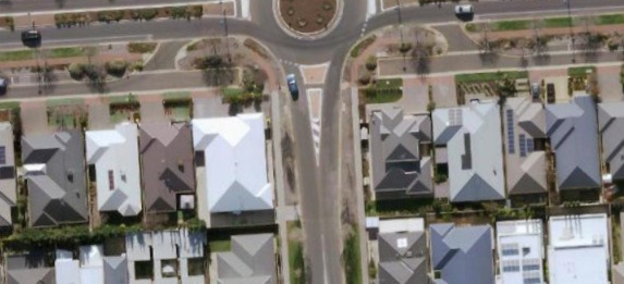
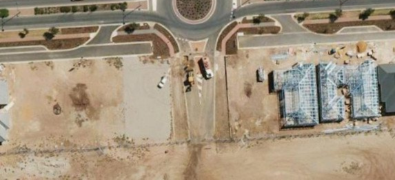
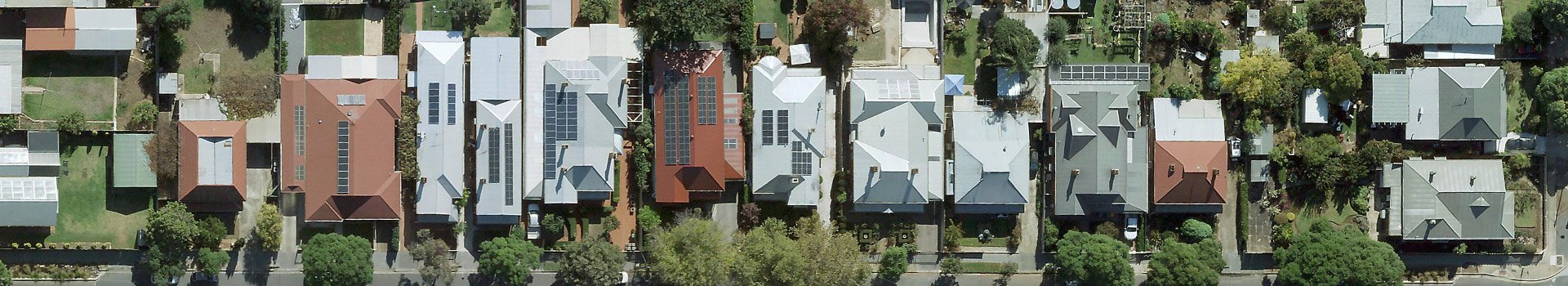
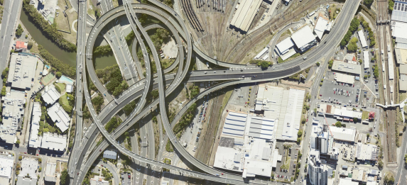
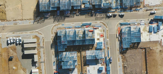
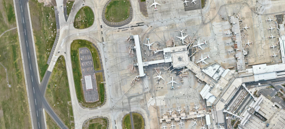
Say goodbye to outdated imagery. Conduct detailed site inspections, take accurate ground measurements, monitor change, see detailed land and building information, and access years of historical imagery without ever leaving your office.
Gain access to up-to-date aerial imagery cost-effectively with our flexible plans & transparent pricing. Choose from our standard plans or custom build one that suits you.
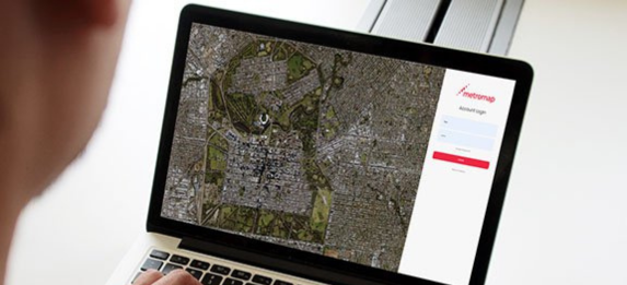
Get easy access via our web-based MapViewer and its extensive tools & features, or import our imagery into your platform of choice with our APIs.
Proudly developed, owned, and operated in Australia, our imagery captures the detail and accuracy needed for local conditions, whether you're planning a backyard project or managing national infrastructure. With extensive coverage and fast local support, you can rely on MetroMap for insights that are truly homegrown.
Imagery is the ultimate communication tool, removing uncertainty and providing context. Use MetroMap to speed up site planning or consult clearly with all stakeholders. Speed up the development and feedback loop with sharp, accurate, and clear imagery.
