Engineering_Construction_Banner

Unlock the Full Potential of Aerial Imagery With MetroMap

When accuracy matters, MetroMap delivers more than just imagery. Access high-resolution, frequently updated aerial data with flexible tools and exceptional value, enabling you to analyze, plan, and execute projects with confidence. Say goodbye to outdated views and restrictive platform. MetroMap keeps your workflow seamless, efficient, and ahead of the curve.

Don't Just Take Our Word For It

Melbourne_Water
Oakford Homes
WSP
Gutter-Vac-Logo
ARTC logo
Oz-Roof-Logo
NSW Transport logo
Virgin Australia logo
Laing orourke logo
SMEC_Logo_Slider
Metro logo
Stantec logo
SA_Power_Networks
City of Onkaparinga logo
Landgate logo
Transgrid logo
BNE logo
Department of Home Affairs logo
Banyule_Council
Domain logo
REA group logo
Acciona
Updated Imagery
Fresh Views When It Matters

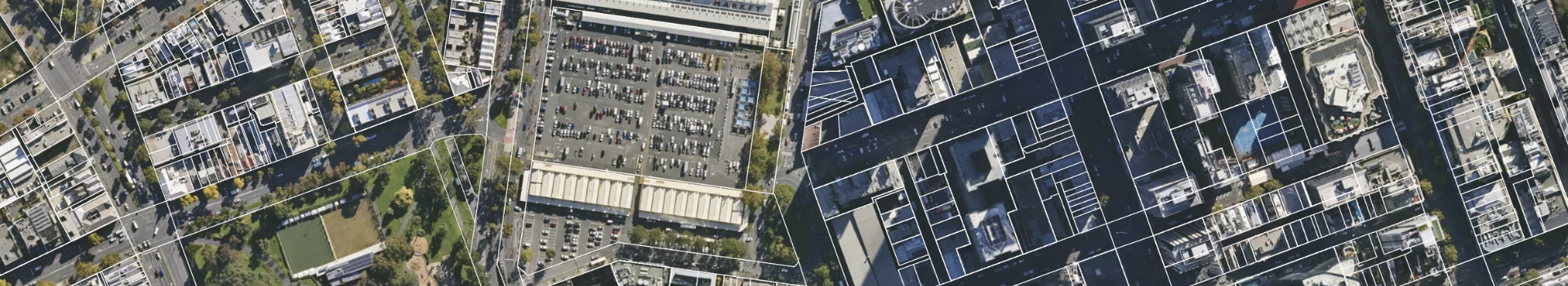
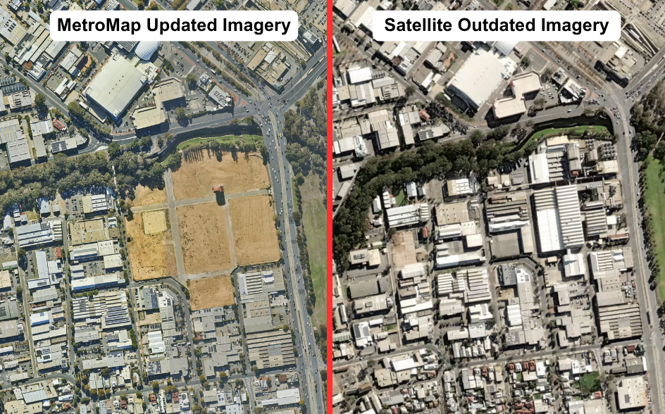
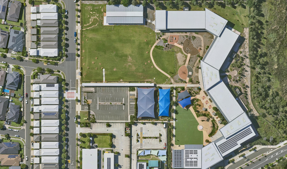
Outdated images can lead to costly mistakes. MetroMap keeps your data current with regular captures across metro and regional areas, so you can trust the view you’re working with.

Start Free Trial

Sydney HR
More Clarity, More Confidence

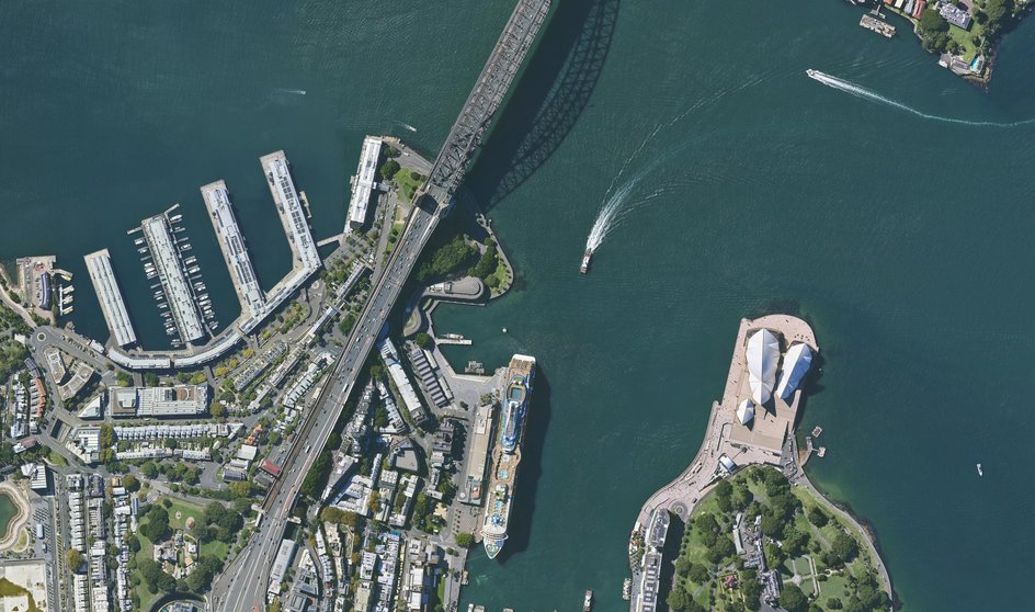
Free maps are fine for browsing, but projects need accuracy. MetroMap delivers high-resolution, regularly updated imagery that gives you the detail to plan, measure, and present with confidence.

Begin Your Free Trial Today

Comp-google-earth-2
Built for Work, Not Just Browsing

Get the data you need, exactly when you need it, without limits or delays. MetroMap puts up-to-date, high-resolution aerial imagery at your fingertips, empowering you to make faster decisions, streamline your workflow, and stay ahead of every project.

Switch To MetroMap

MetroMap Tools
From Viewing to Doing

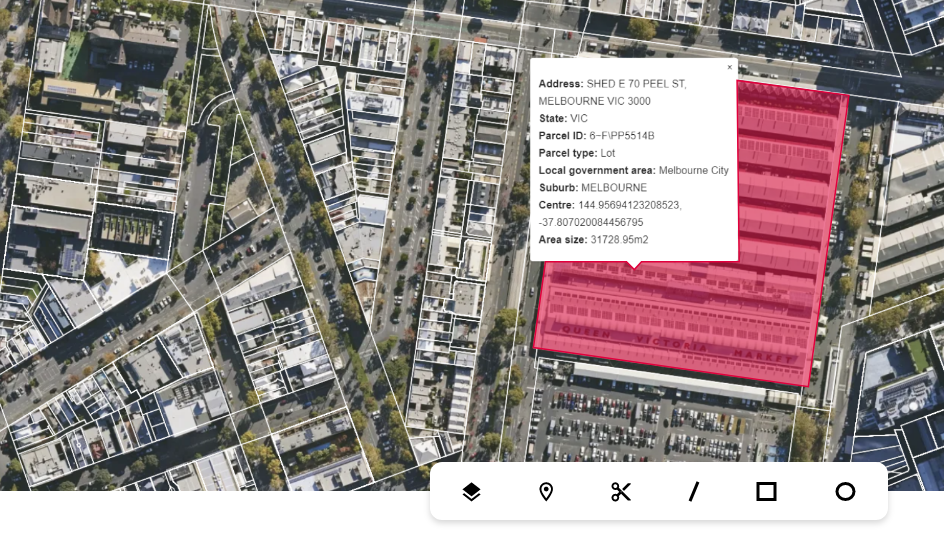
Go beyond static images. With MetroMap you can measure distance, check elevation, compare timelines, and extract insights directly from your aerial data, all in one simple platform.

Check It Out For Yourself

Sales support
A Partner You Can Count On

Backed by decades of experience and Australian ownership, MetroMap combines advanced technology with approachable support to help you get real value from your aerial data.

Experience Our Service


Discover the clarity, accuracy, and control your projects deserve. With MetroMap, you’ll get high-resolution imagery, flexible plans, and local support designed for professionals like you.